I had two events (Moab & The Wedge) planned back to back so I thought I would combine them and be gone 10 days straight.
First was to Moab for the 4-man / 4-women team event sponsored by the UGA. I hauled my trailer to Dennis and Traci Udinks place in Price on Thursday (Oct 13th), dropped it off and then headed on down to Moab. The tournament was good and I enjoyed the golf, the scenery and the company. I then headed back to Price on Saturday (Oct 15th), shopped and loaded my trailer. Sunday, I attended church with Traci and then headed to the San Rafael Swell (The Wedge). I took the long route down to Castle Dale since I had never been there. It was 20 miles to the Wedge area. We were going to have camp #5 but it was already occupied so I camped in #6. Sunday night I just pulled in and left the truck hooked up hoping that the people in #5 would be pulling out. They didn't so I pulled in by the little hill and unhitched. My front end was jacked up so high that it made the trailer wobbly. The next morning I hooked back up & moved the trailer to a flat area on the east side of #6.
 |
| Camp at site #6 |
Monday & Tuesday I explored the surrounding area & picked up a few caches. I also placed a few caches.
 |
| Nice view of the Wedge (looking south) |
 |
| Little Grand Canyon |
 |
| Nice rock formation |
 |
| Wedge pond #1 (new cache hidden close by) |
 |
| The Wedge |
 |
| Close by a cache. Cool rock formation |
 |
| West side of Wedge |
 |
| West Wedge |
Dennis came Tuesday afternoon. We went to talk to the people in spot #5 & they were leaving Thursday so we decided to stay where we were in #6 and change the cache page so that those individuals who were coming this weekend would know. I also put out my signs showing where we were camped. The temperature during the days was in the 60's and at night in the low 30's. By Friday I think the temp climbed into the 70's. Nice and warm.
 |
| Dennis trailer (far right) and mine |
Wednesday - Dennis & I went to Buckhorn wash, picked up a few caches then headed to the railroad tracks to pick up a FTF. We looked a good 45 min but came up empty. The hiding place had a lot of shale rock that would tumble down when you got close. The rating should not have been a 1.5 difficulty. I walked to several caches & my knee was hurting so much I had to take a strong pain pill but I kept going. I walked more Wednesday than I did in several months combined. I was tired but it felt good. Just as we got back to camp, Keith & Vickie ( cowboyz) showed up. After they set up camp, their friends from Logan also showed up.
At dusk, Dennis & I headed to the Wedge to take pictures & burn steel wool. He showed me how to take night pics. It was neat. When the sun had gone down, Dennis lit the steel wool on fire & then spun it around over his head. We had the shutter speed set for 15 sec. That was one of the coolest pictures I had ever seen. Dennis standing at the very edge on the cliff surrounded by shooting sparks. Cool. We were trying to be careful but one of the sparks caught a bush on fire over the cliff. Dennis couldn't get it with the extinguisher so we pored water on it. Thank goodness it was a lone bush. That was funny.
 |
| Dennis twirling steel wool on fire. He caught a bush on fire over the edge of the cliff. |
 |
| Best one yet |
Thursday - I went out and placed a few caches and explored the area some. Traci and the boys showed up in the afternoon.
Friday - We explored a trail I had been on that Dennis wanted to go on. We took pictures of the west end of the wedge. Pretty cool area. On the way back Traci wasn't feeling well so she took the boys and headed back to camp. Dennis and I decided to explore some old trails and went cowboying out in the middle of nowhere. We had to use 4wheel drive to get through a few gully's.
 |
| Michael (top) and Bradley |
 |
| Cool rock formation. I wonder if there is any pizza in there? |
 |
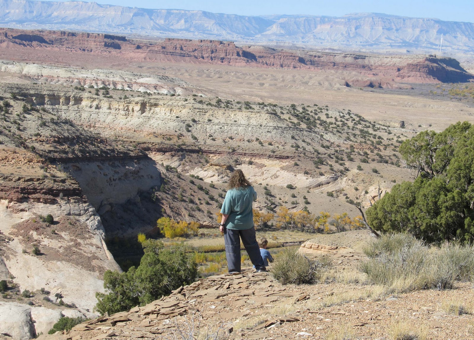
| Traci and the boys by a survey marker |
 |
| Dennis looking into Little Grand Canyon |
 |
| Traci looking into Fuller bottom |
|
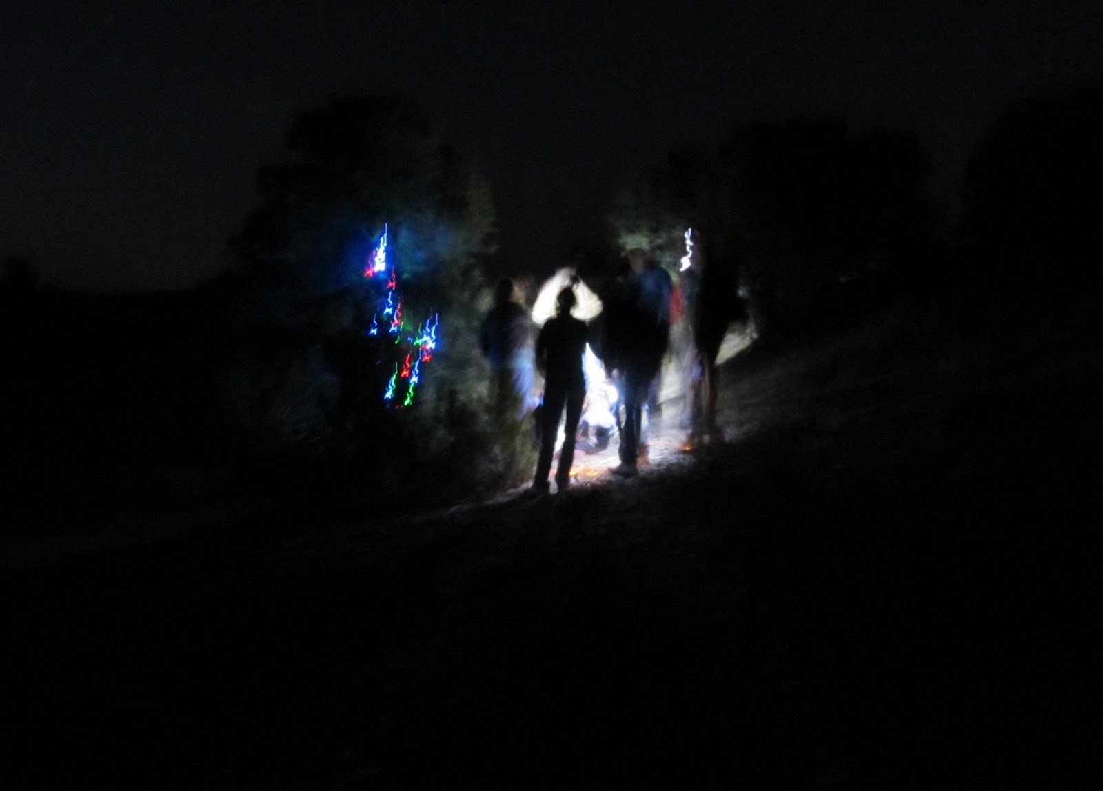
Friday night we did a few night caches, one that was called the Christmas Tree cache. It was cool. My pictures did not turn out too good since I did not have a tripod. I was shaking too much but the tree was lit with solar powered Christmas lights. Way cool.
 |
| Looking for the Christmas Tree cache |
 |
| Christmas Tree cache |
Saturday - rode 65 miles to Cedar Mountain overlook. Great views, great fun, great people. Had potluck dinner at night. Tired!!!
 |
| Ken taking pictures |
 |
| Ken and Jan by a neat pool (currently empty) |
 |
| This type of rock cuts fingers real quick |
 |
| Looking into the Wedge from Cedar Mountain Overlook |
 |
| Chris trying to convince the kids the crack is nothing to jump across |
 |
| Jan and Ken |
 |
| Smart Torrey (the dog). Dennis (sitting) and Chris looking on |
 |
| Chris texting on Facebook |
 |
| Jan finding the cache |
 |
| Dennis (red), Chris (blk), Kim (back) and Jan writing everyone's name in log |
 |
| Ken (walking) and Chris (on 4-wheeler), Torrey relaxing |
 |
| Potluck dinner |
 |
| Kim (far left), guy from Huntington, Chris (back turned), Utah Jean |
 |
| Chris (far left), Utah Jean (blue coat), Keith (red coat), Kim, Keith's friend (facing away) |
Here are some additional pics of the area and week.
 |
| Wild horses |
 |
| Rincon Canyon |
 |
| The Wedge |
 |
| Dinosaur track in Buckhorn Flat |
 |
| Rock art in Buckhorn Flat |
 |
| Dennis coming back from taking picture of rock art |
 |
| Where can I rappel today? |
 |
| Chris taking a power nap after a long weekend |